
 Activities & Sports
 Head north out of Kaş and within an hour and a half the Mediterranean is gone. The road climbs through red pine, then through cedar, and puts you down in Gömbe, a highland village at 1,200 metres where the thermometer sits eight or ten degrees below the harbour you left. It is 66 km from Luna Kaş, close enough for a day out and far enough up that it is a change of climate rather than a change of scenery.
What is up there: a lake the colour its name promises, a waterfall that only runs for part of the year, cedar forest as good as any on this side of the Taurus, and countryside restaurants where the goat goes into a wood oven in the morning and comes out at lunch. Take a jacket. Almost everybody underestimates that part.
Getting to Gömbe from Kaş
Eight kilometres east on the D400, then north onto the Kaş to Elmalı road, which does all of the climbing. Sixty-six kilometres in total and roughly an hour and a half. The distance is modest; the road is a mountain road and the bends never really stop. Anyone prone to car sickness should take the front seat and mean it.
By car is the honest answer. There are minibuses from Kaş heading up towards Elmalı, but the service is seasonal and thin, and none of it will carry you the last stretch up to the lake. If you want Yeşilgöl and the waterfall in the same day, drive or agree a day rate with a taxi. Our Kaş transport guide covers the local network in more detail.
The main road stays open through the winter in a normal year. The tracks above the village are a different matter, and snow shuts them for weeks at a time. Between late May and the end of September everything described here is reachable in an ordinary car; outside that window, ask in the village before you commit to the climb.
Yeşilgöl, the Green Lake
Yeşilgöl sits at about 1,800 metres in a bowl under the wall of Akdağ. It is six or seven kilometres up from the village on a rough surface, and the last part is slow going, so allow twenty minutes rather than the ten the map suggests.
Nearly everything written about this lake calls it a crater lake. It is not one, and there are no volcanoes in this part of the Taurus. The geologists who mapped it describe a landslide: a slab of limestone and conglomerate slid along a fault plane where it met softer claystone, and the debris dammed the valley. Karst springs fill the basin from below and a karst outlet drains it at the far rim, which is why the level barely moves and why you can see the bottom.
It is also why the water is cold. It comes off the snow on Akdağ and travels underground to get here, and it holds around 12 degrees in August. People do swim. They do not swim for long.
There is no cafe at the lake and very little shade once you are out from under the trees. Carry water and lunch up with you, and carry the rubbish back down.
Uçarsu Waterfall
Roughly 800 metres from the lake, a quarter of an hour on foot, the water comes straight out of the mountainside at about 1,850 metres and drops some fifty metres off a rock face with a cave beneath it. Uçarsu means flying water, which is a fair description of what it does in June. You will also see it written Uçansu on maps and signs; it is the same fall.
It is seasonal, and this matters more than anything else here. The flow starts in the first week of May as the snowpack on Akdağ lets go, and holds through August and sometimes into September. Arrive in late October and you will be looking at a damp cliff.
The story told in Gömbe is that the water changes direction with the seasons, running towards Seydikemer in Muğla through the winter and back towards the highland in summer. Inside a limestone massif threaded with underground drainage that is less fanciful than it sounds, and it has seeded a good many local legends either way. What is not in doubt is that the fall exists for only part of the year, and that is the part worth planning around.
The Cedars
The cedar is why the forest up here looks nothing like the pine you drove through to reach it. Cedrus libani, the cedar of Lebanon, grows tall and flat-topped and smells of resin on a warm afternoon, and it takes centuries to do it. The stands around Gömbe are among the best you can walk into without a permit and a long approach.
You will be told, in the village and in most of what has been written about it, that these cedars grow in only two places on earth: here and Beirut. It is a good line and it is not true. Turkey holds well over half the world’s cedar of Lebanon, something above 400,000 hectares of it, running along the Taurus from the western end as far as Hatay. What is left in Lebanon amounts to a couple of thousand hectares and in Syria to a few hundred. The tree is genuinely rare, genuinely slow and genuinely worth protecting; Gömbe’s forests simply are not the last two on the planet.
Down by the reservoir below the village stands a cedar that people here date to twelve hundred years. Ask about it and somebody will point.
What to Do Up There
Beyond the lake and the waterfall, which most people come for.
Walk the cedar forest
Marked trails run out of the village in several directions under old cedar and black pine. Easy going, deep shade, and cool even in August.
Akdağ and Uyluk Tepe
At 3,016 metres this is the roof of the western Taurus. A serious mountain, usually climbed over two days, and not one to attempt without a guide and proper kit.
İkiz Göl
Twin lakes at around 2,300 metres on the Akdağ plateau, above the treeline. A long walk from the nearest road with no facilities at either end.
Çayboğazı reservoir
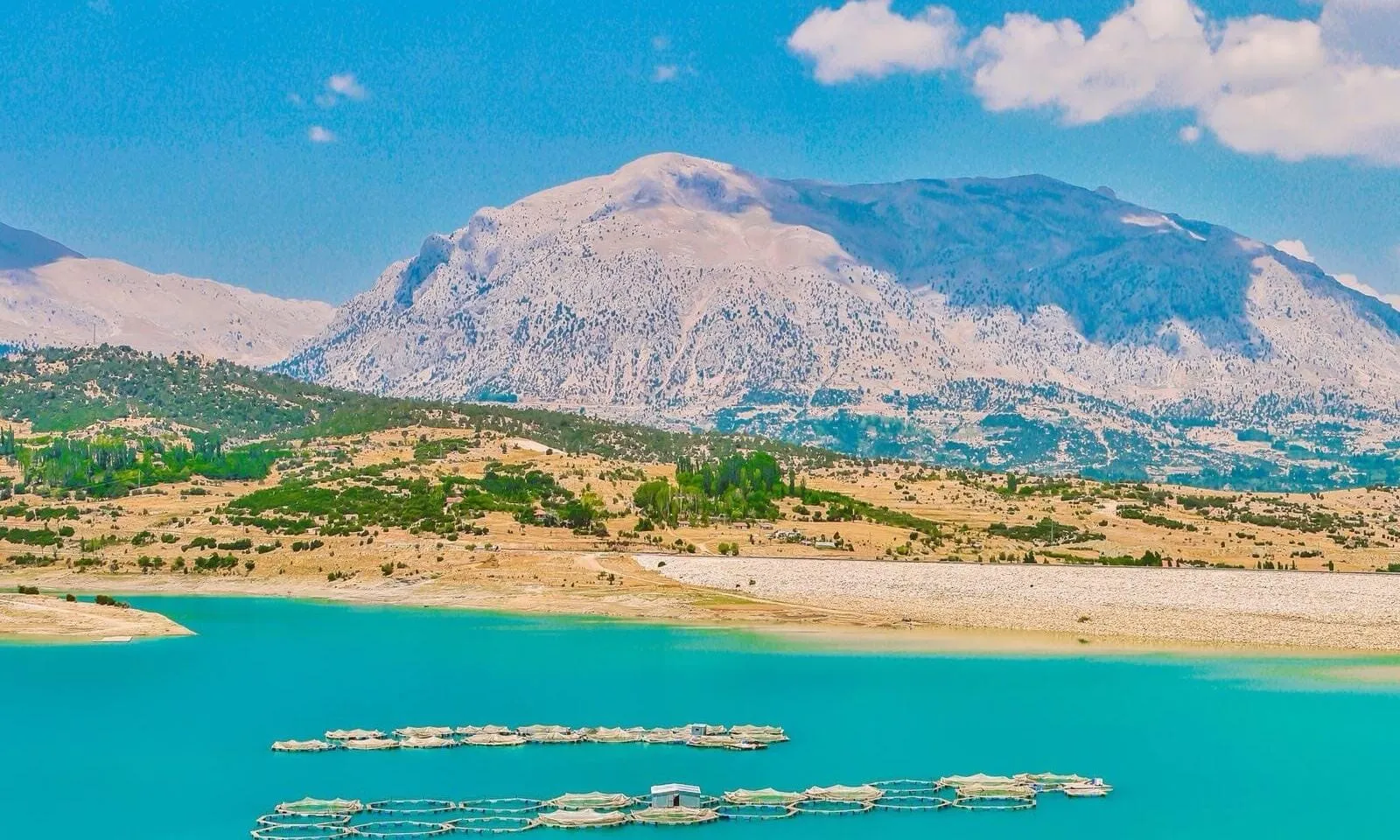
Ten minutes below the village, with Akdağ standing behind the water. Trout are farmed here and served in the restaurants the same day.
The August fair
The Gömbe fair goes back to the Ottoman livestock markets and the oil wrestling that came with them. Today there is a re-enacted Yörük migration, zeybek teams and folk dancing.
Winter by the stove
Snow closes the tracks and empties the highland. What is left is a wood stove, an unhurried conversation and a completely different mountain.
What to Eat in Gömbe
Two things are worth planning the day around. Gömbe kebabı is young goat cooked slowly in a wood-fired oven until it comes off the bone; it goes in early and it is ready at lunch, so on a busy weekend either call ahead or arrive before the tables fill. Gömbe çöreği is the local bread ring, plain or worked through with walnut or poppy seed, and it travels well enough that most people drive home with one on the back seat.
You eat both at the kır lokantaları, the countryside restaurants set beside the streams coming down off the peaks. They are plain places with plastic chairs and no menu to speak of. The tomatoes are better than they have any right to be, the water is straight off the mountain, and nobody hurries you. Trout from the reservoir is on most tables, and in season so are the apples, pears and walnuts from the orchards around the village.
If you are up here in high summer, ask about karlama: snow packed away since winter, dug out and served with grape molasses poured over it. It is a highland dessert and it makes complete sense at 1,200 metres in August. For eating back down at sea level, our guide to where to eat in Kaş has the town covered.
A Day in Gömbe from Kaş
One long day, unhurried, back at the sea by evening.
08:00 Leave Kaş
10:00 Yeşilgöl
11:00 Uçarsu
13:00 Lunch in the village
15:00 Cedars and the reservoir
17:00 Start back down
Take a jacket even in August. The temperature at the lake falls quickly once the sun is off it, and the road down is not one to hurry in the dark.
Frequently Asked Questions
How far is Gömbe from Kaş?
66 km, and about an hour and a half of driving. You head east on the D400 for eight kilometres, then north onto the Kaş to Elmalı road, which climbs the whole way. It works comfortably as a day trip.
When does the Uçarsu waterfall actually run?
From the first week of May, when the snowpack on Akdağ starts to go, through August and sometimes into September. It is fed entirely by snowmelt, so outside that window there is little or no water.
Can you swim in Yeşilgöl?
Yes, and people do. The water is fed by karst springs carrying snowmelt off Akdağ and stays around 12 degrees even in August, so most swims are short. There are no facilities of any kind at the lake.
Is Yeşilgöl a crater lake?
No, although it is described that way almost everywhere. There is no volcanic activity in this part of the Taurus. The lake was formed by a landslide that dammed the valley, and it is fed and drained by karst springs.
Do cedars really grow only in Gömbe and Beirut?
No. It is a story you will hear locally, but Turkey holds more than half of all the cedar of Lebanon in the world, spread along the Taurus mountains. Gömbe’s stands are beautiful and old; they are not the last two.
What should I eat in Gömbe?
Gömbe kebabı, young goat slow-cooked in a wood oven, and Gömbe çöreği, the local bread ring with walnut or poppy seed. Trout from the reservoir is widely served, and in high summer ask for karlama, packed winter snow with grape molasses.
Can you reach Gömbe without a car?
It is difficult. Minibuses run up towards Elmalı but the service is seasonal and infrequent, and nothing public goes the last stretch to the lake or the waterfall. Driving, or hiring a taxi for the day, is the practical option.
SIXTY-SIX KILOMETRES, ANOTHER CLIMATE
Cold water, cedar smoke and goat kebab, and back down to the sea by evening.
Luna Kaş is where the day ends.